VIEW HIGH RESOLUTION ZOOMABLE IMAGE
maps of egypt and libya
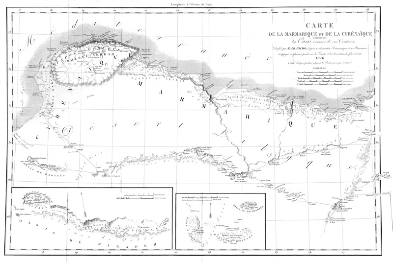
Pacho's Map
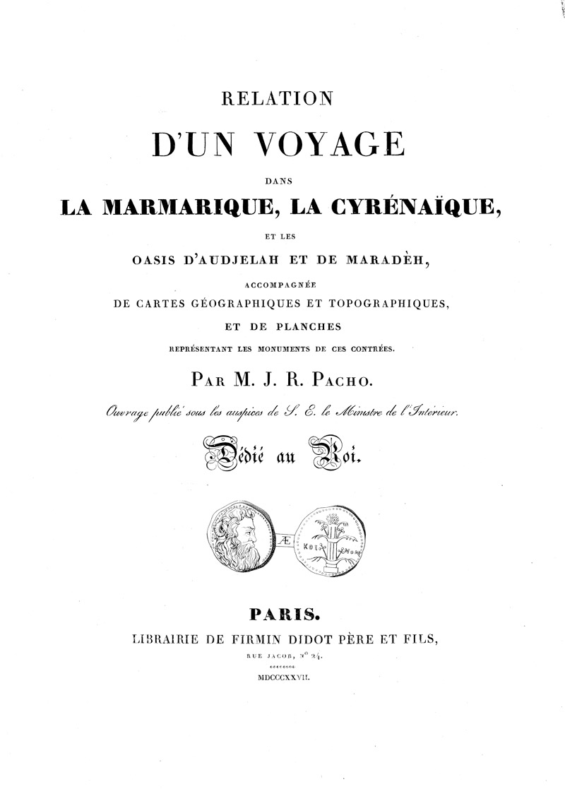
Jean-Raymond Pacho (1794-1829) was a French explorer who in 1827 published his book (followed by a second atlas volume in 1829) Relation d’un Voyage dans La Marmarique, La Cyrénaïque, et les Oasis d’Audjelah et de Maradèh [Relation of a Journey through Marmarica, Cyrenaica, and the Oases of Audjelah and Maradeh], at Paris. The book was ‘published under the auspices of the Minster of the Interior’, and hence was viewed with considerable official favour. (See the pdf of the title page of the volume.) Marmarica is an ancient name for the Mediterranean coastal regions between Cyrene and Egypt. The Foundation has an original of Pacho’s map of Eastern Libya and Western Egypt, reaching as far as Alexandria and Rosetta in the Egyptian Delta, and extending as far west as the bottom of the eastern side of the Gulf of Sirte. This is now made available here as an image with magnifying software (keep clicking and it gets larger and larger), and also as a pdf download. The map includes rare maps of four Libyan oases in considerable detail. The region of the Oasis of Siwa is also shown in detail, under the name of Syouah. Interesting details emerge from this early map, such as an indication of the Mataleb Ruins east of the Oasis of Bahariyah. Locations of springs are carefully mapped along desert routes. This rare old map is extremely valuable in showing the state of things at the early date of 1826, before any modern development had taken place.
Download as a high resolution PDF
Maps of Egypt and Libya
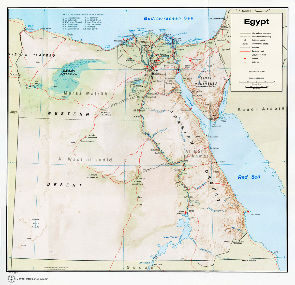
Central Intelligence Agency (CIA) map of Egypt, 1967.
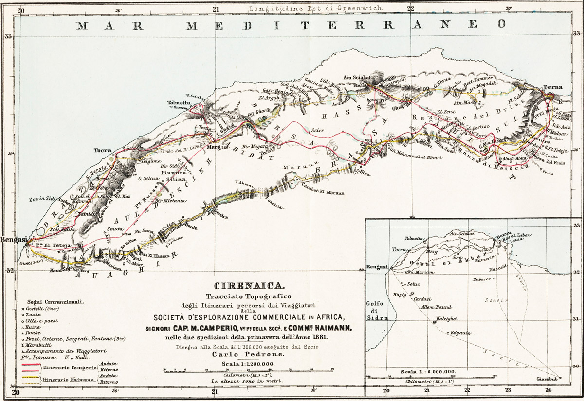
Folding map at the back of Giuseppe Haimann, Cirenaica Rome, 1882 (in Italian).
Map showing Siwa, C. Dalrymple Belgrave, 1923.
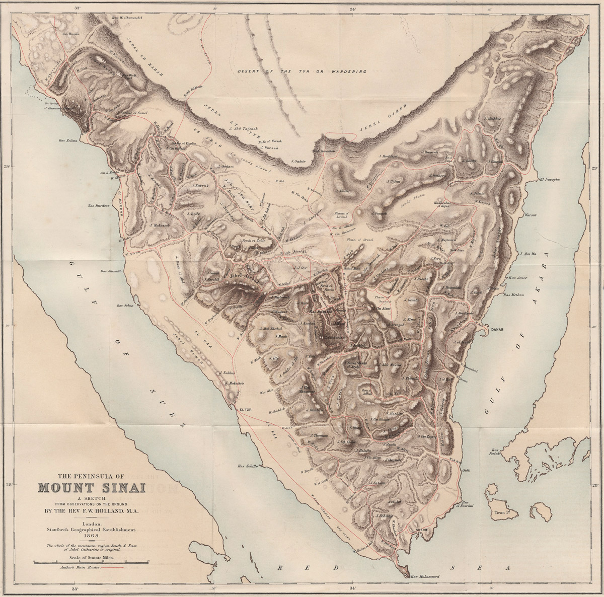
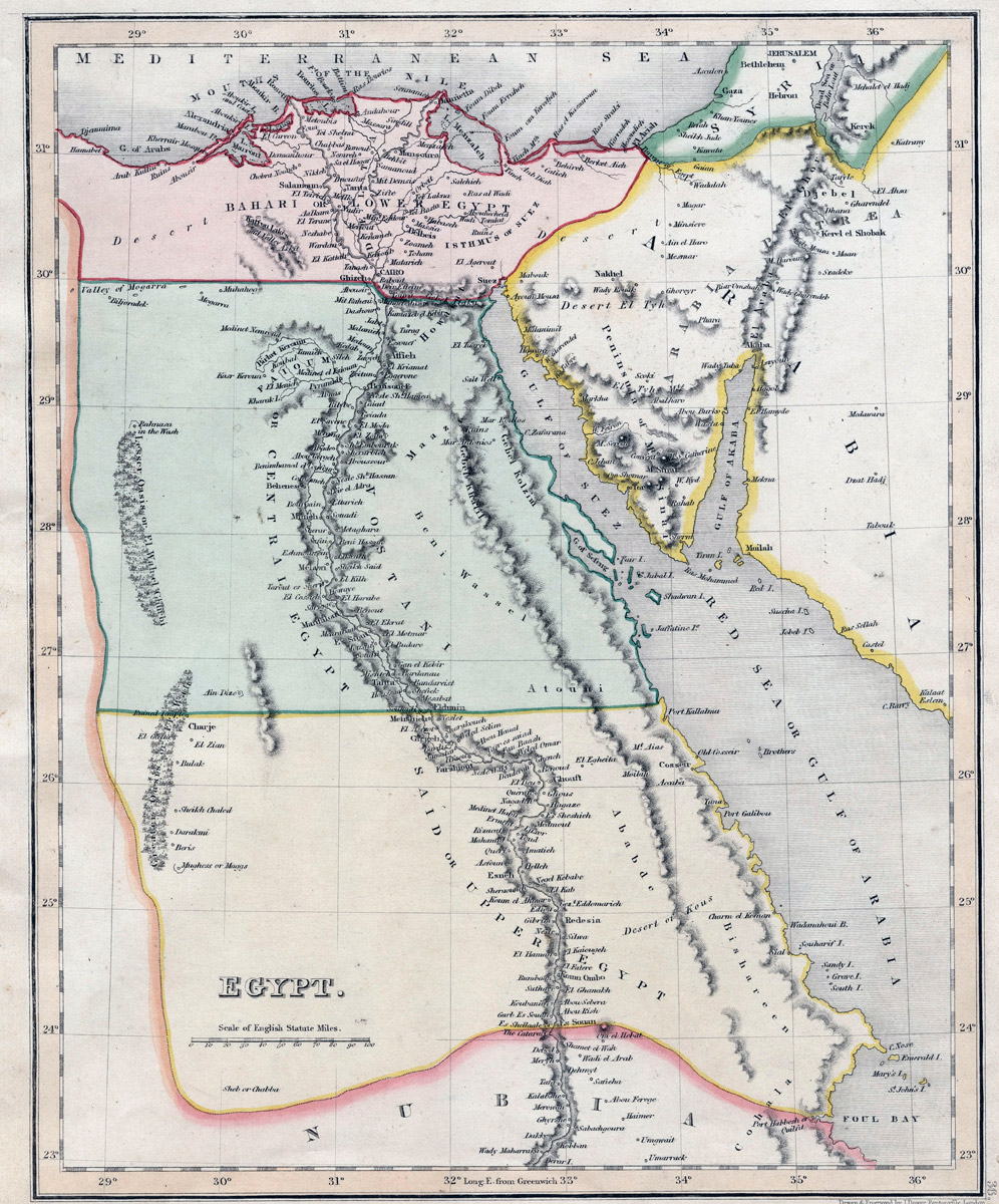
Map of the Peninsula of Sinai by Rev. F. W. Holland, 1869.
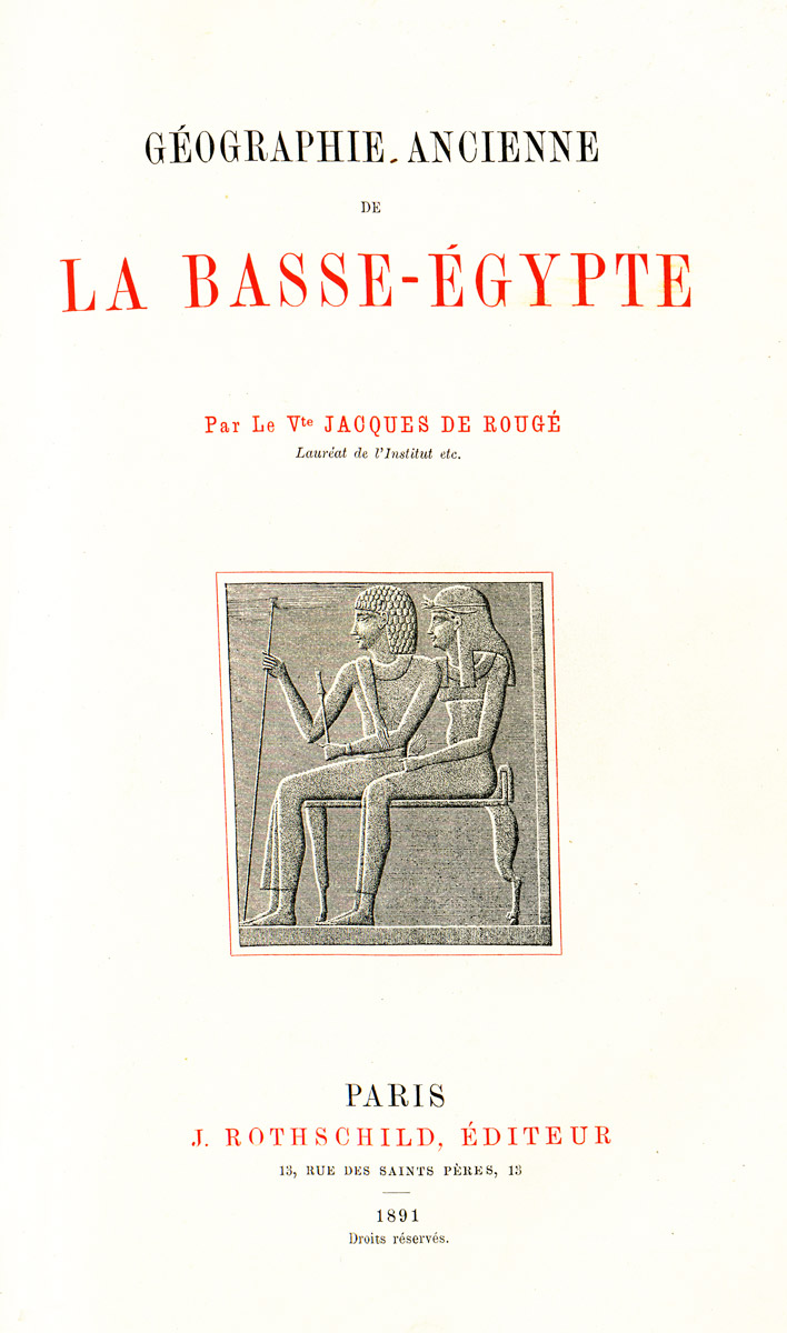
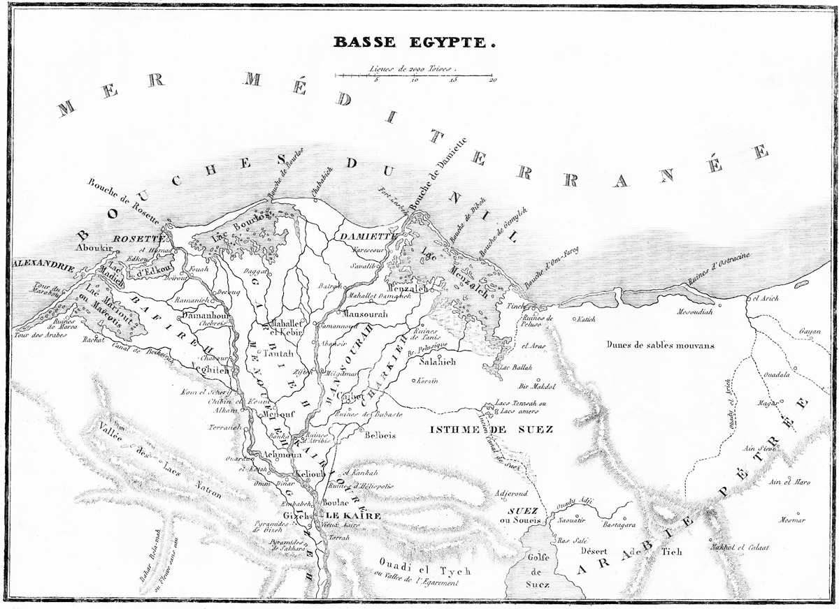
Cover of Rougé's book Géographie Ancienne de la Basse-Égypte, 1890.
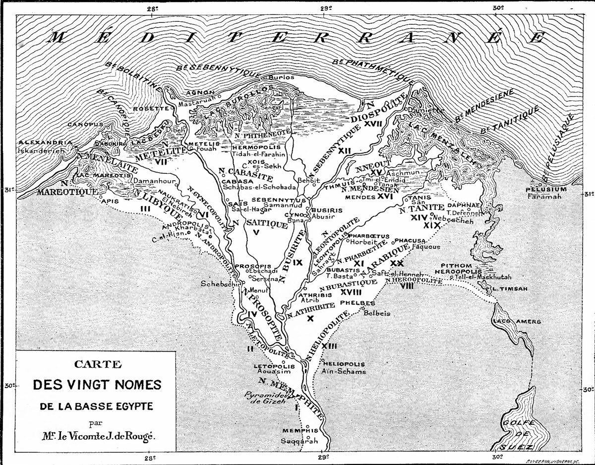
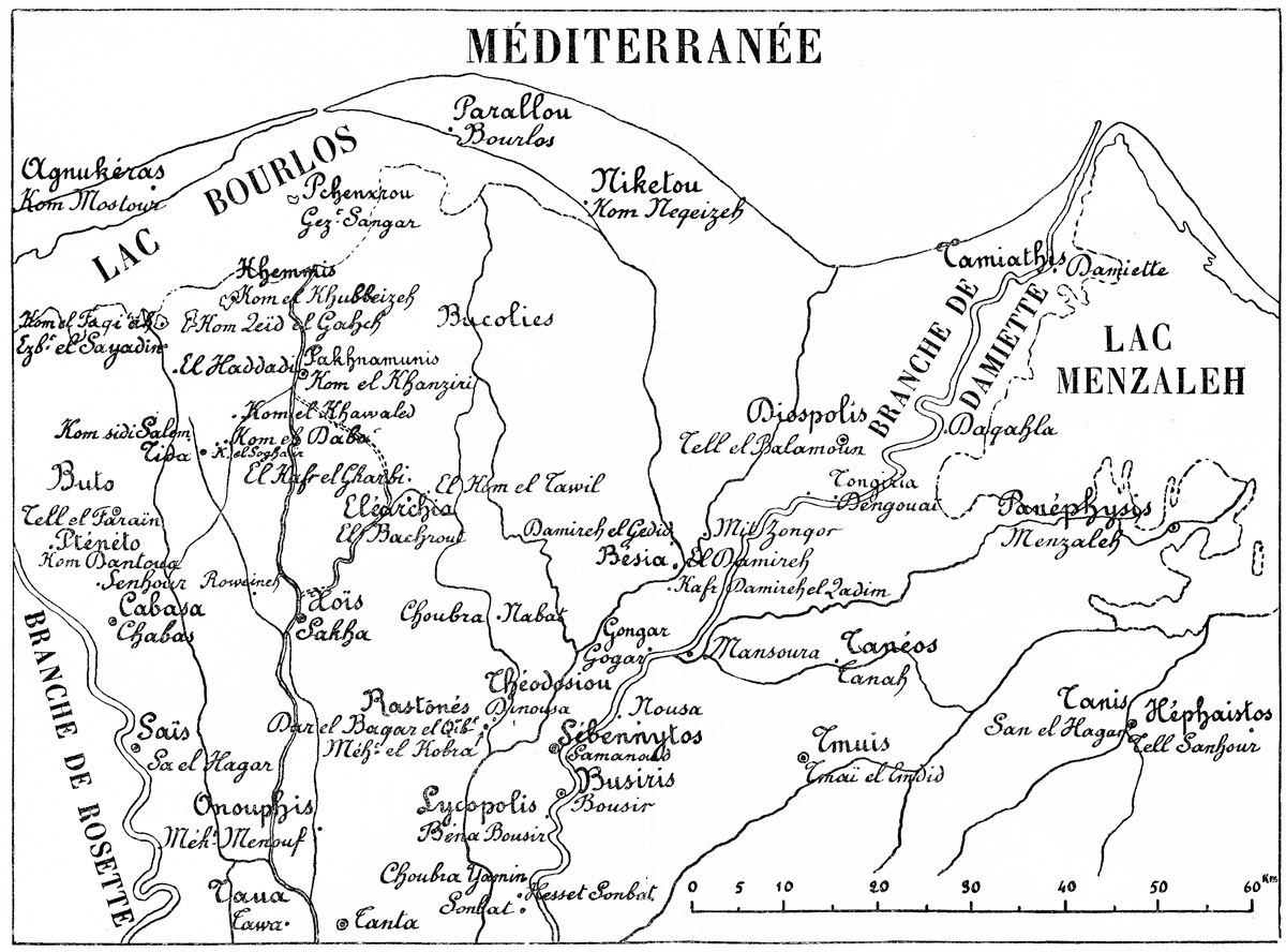
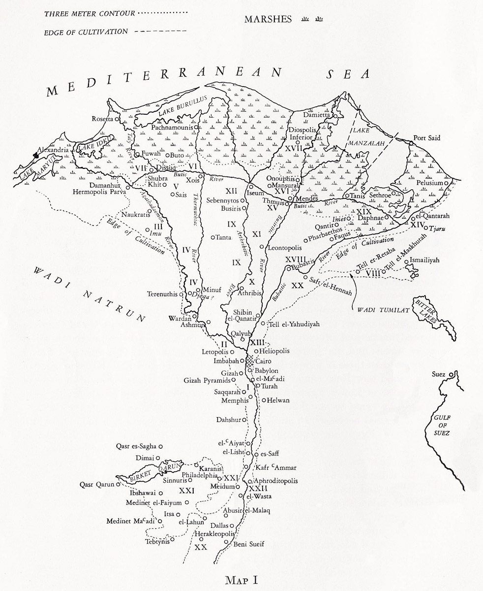
Rougé's Map of the Twenty Nomes of Lower Egypt, 1890.
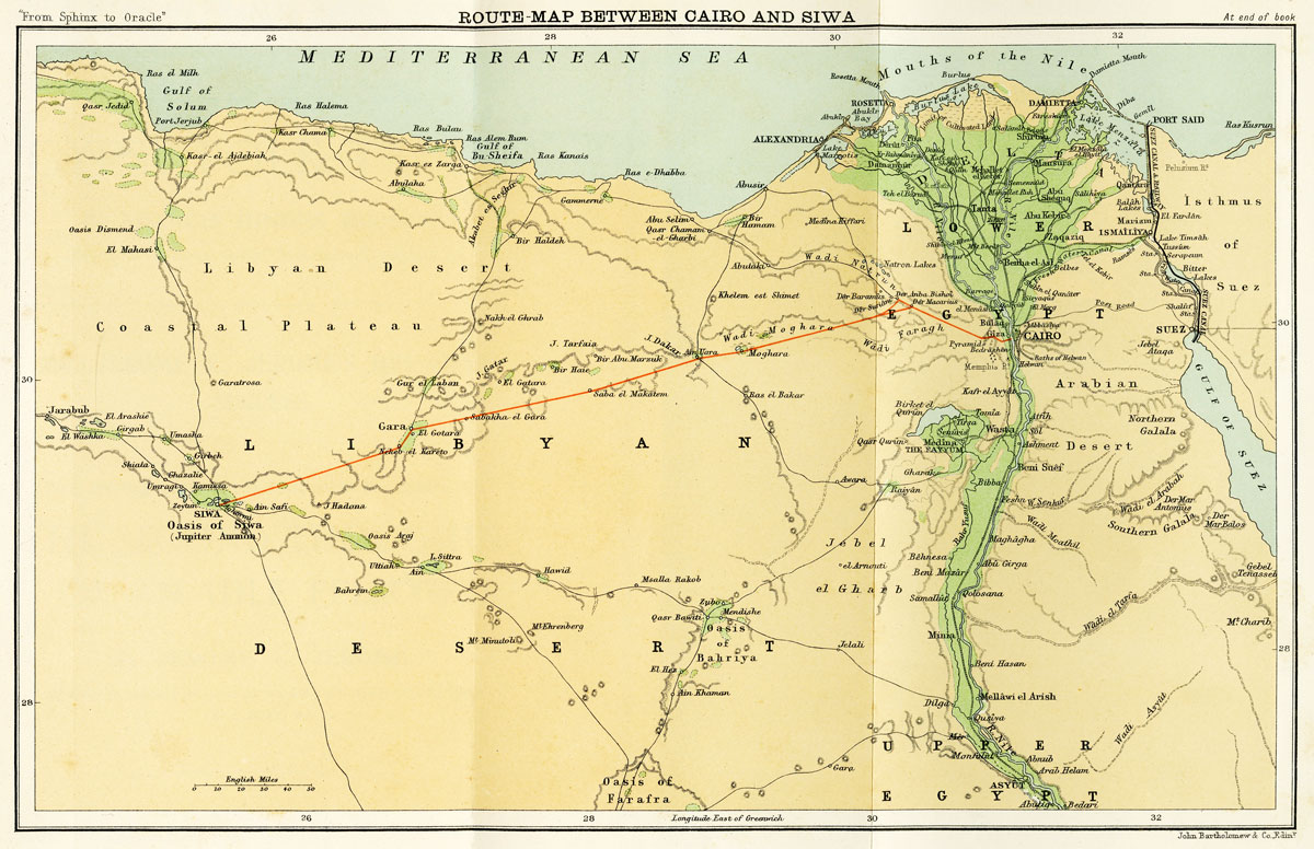
Arthur Silva White’s map of 1899 showing his route from Cairo to the Oasis of Siwa.
Arthur Silva White’s map of the Egyptian and Libyan oases of 1899.
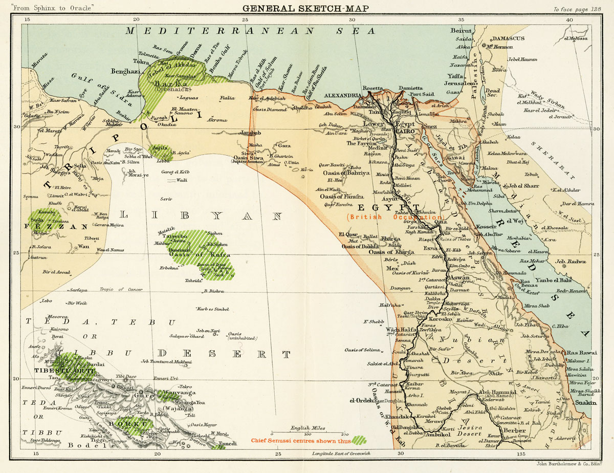
Major Harold Nockolds’ Map used in the North Africa Campaign by Montgomery’s staff.
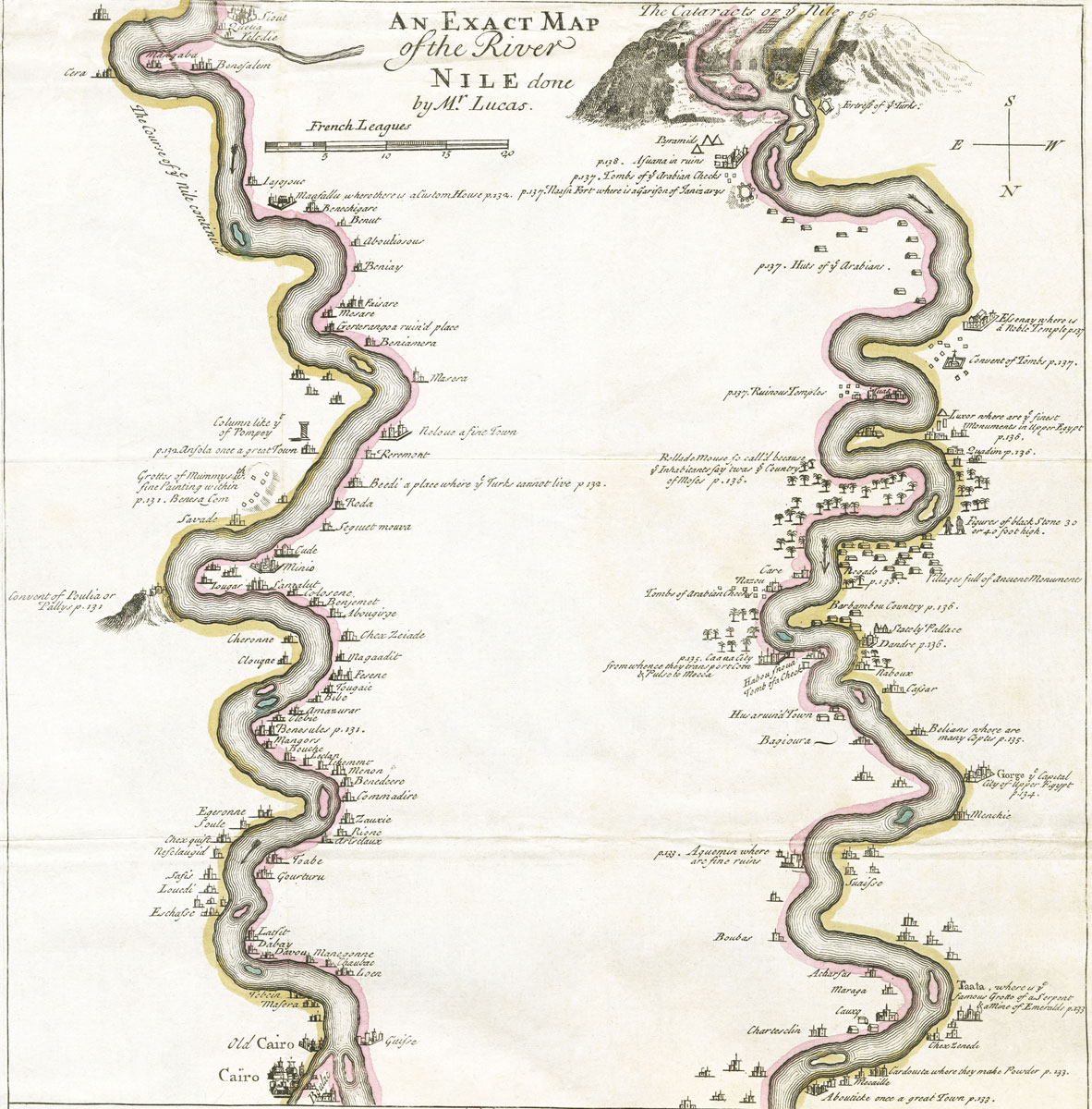
Moll's 1714 Map of the Nile.
Map of Egypt and Libya (detail of old Rand McNally Map of Africa, no date, sinusoidal projection).
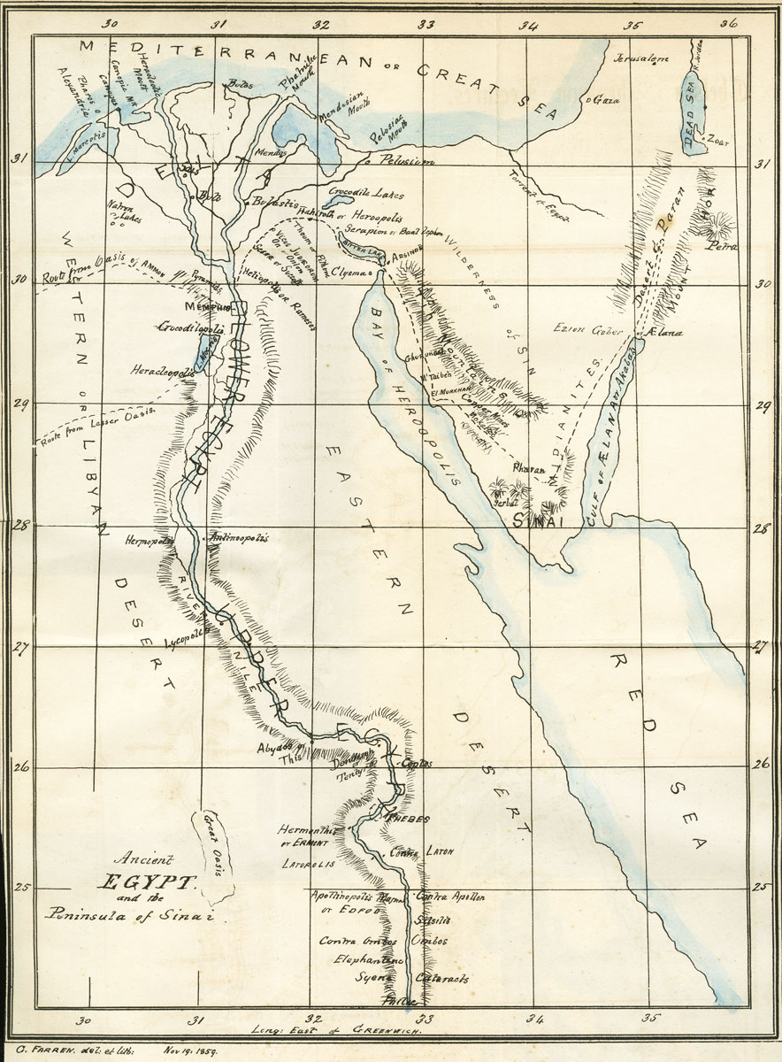
The Map of Ancient Egypt drawn by George Farren in 1859.
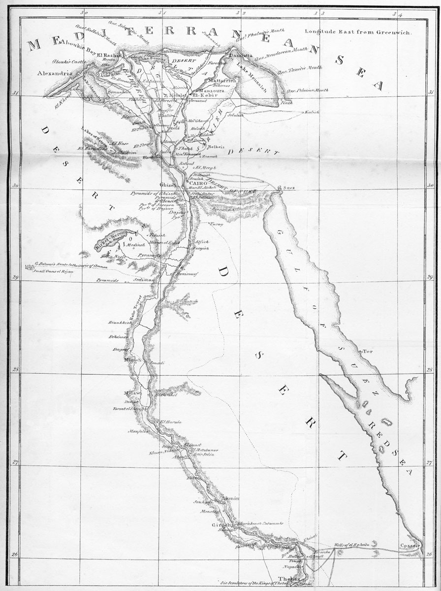
Reproduction of Leakes’ map of the Nile, Giovanni Belzoni. 1821. (The bottom half is shown in the next image.)
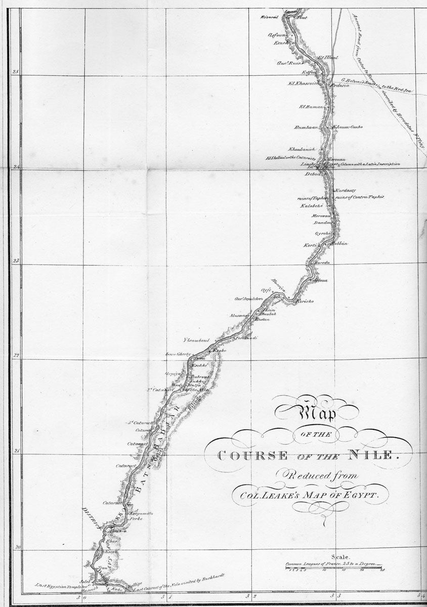
Bottom half of Belzoni’s reproduction of Leakes’ map.